
Falmouth Coastguard
The following images are © David Searle and should not be used elsewhere without his permission.
Click on the small image for a larger version
Click on the small image for a larger version
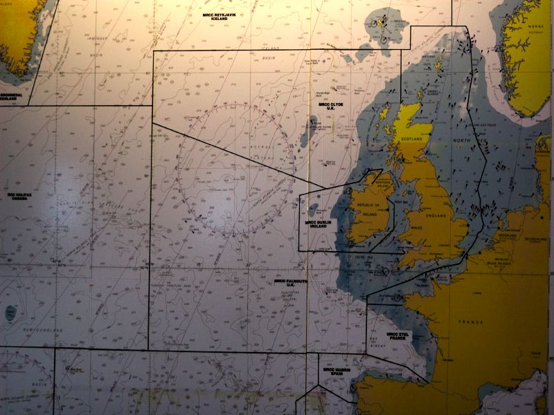
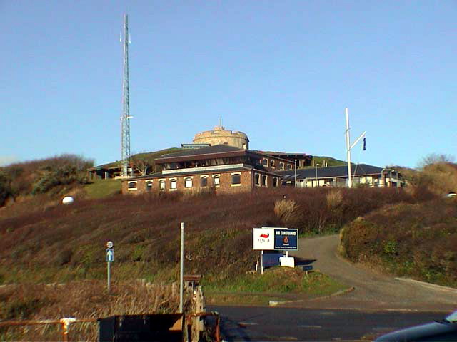
CGOC Falmouth opened in 1981 and is the most southwestern Coastguard station in the United Kingdom. It is responsible for civil maritime search & rescue for most of the coast of Cornwall. The area begins at the Devon & Cornwall border on the north coast of Cornwall, and includes Lands End and the Isles of Scilly, up as far as Dodman Point on the south coast. The area also extends out to 30 degrees west and to 45 degrees north. This gives the station the biggest Search and Rescue region of any station in western Europe - around 660,000 square miles.
The station controls 7 VHF sites and 2 MF sites including one of each in the Isles of Scilly. To communicate with vessels outside the normal range of VHF radio, the station is equipped with Inmarsat C equipment. The normal method of communication using Inmarsat is via LES Burum, although the station can go direct to the satellites if necessary.
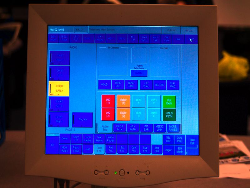
Control of the remote VHF and MF radio systems is carried out using touch-screens like this one. It also handles all incoming telephone calls. It allows link calls to be made, primarily for the provision of medical advice, but will allow any radio or telephone circuit to be connected to any other radio or telephone circuit, and allows conferencing of both radio and telephone.
It also handles the maritime safety voice broadcasts. The operator records weather forecasts and other information into the system. At the correct time, the system will tune the transmitters to the required broadcast channels and transmit all the recordings, and then return the transmitters to the original channels. This system is networked allowing operators to log-in to other Coastguard stations and control their radio sites and answer their telephones if required.
It also handles the maritime safety voice broadcasts. The operator records weather forecasts and other information into the system. At the correct time, the system will tune the transmitters to the required broadcast channels and transmit all the recordings, and then return the transmitters to the original channels. This system is networked allowing operators to log-in to other Coastguard stations and control their radio sites and answer their telephones if required.
CGOC Falmouth also controls the United Kingdom Navtex system. This comprises 3 MF transmitters at Niton, Portpatrick and Cullercoats. Again, information from the Met Office is 'pasted' into the Navtex program on one of the workstations. The Navtex program fires up the correct transmitter at the right time, selects either 490kHz or 518kHz, transmits the messages, then shuts down the transmitter. There are several receivers located around the UK coast which ensure the frequency is free before urgent messages are transmitted.
The system is 'networked', allowing any UK Coastguard station to control the system. Currently CGOC Humber takes over control of the Navtex system for 2 or 3 days a week, so that the system will remain operational even if CGOC Falmouth went off-air for any reason.
The system is 'networked', allowing any UK Coastguard station to control the system. Currently CGOC Humber takes over control of the Navtex system for 2 or 3 days a week, so that the system will remain operational even if CGOC Falmouth went off-air for any reason.
 |
 |
|---|
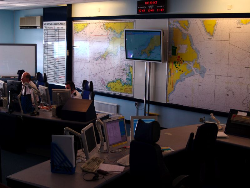
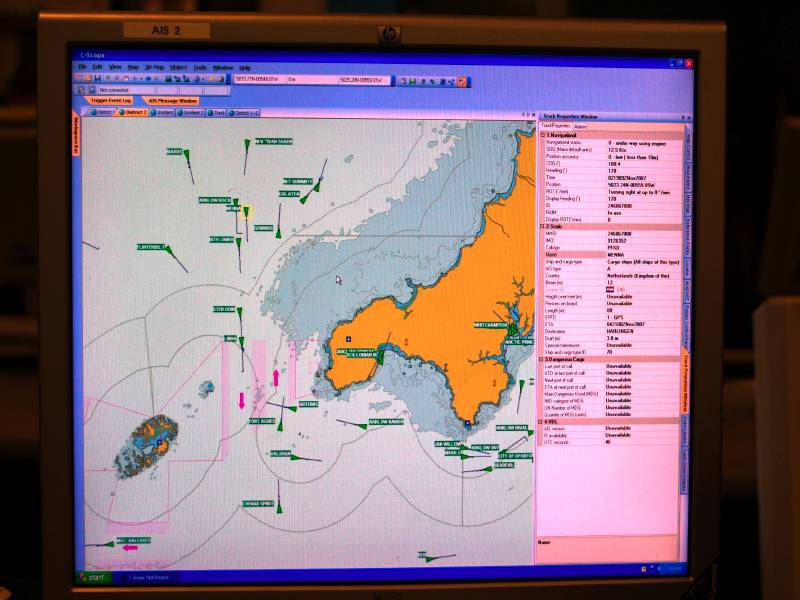
The large screen by the wallcharts is an AIS display. This is a national system which shows the position, course, speed and destination of any vessel equipped with AIS transponders, together with lots of other information. Unlike radar, the display can be zoomed out to show the whole of the British Isles, and gives a range of about 60 miles in normal conditions. During enhanced propagation, vessels as far away as the north coast of Spain may be picked up.
The station took over many functions of the BT Coast Radio Stations when they closed, including the MF 2182kHz distress watch, the Navtex system, Safety broadcasts and medical link calls. In fact it was the 'home' of Pendennis Radio on channel 62 and 66, remotely controlled by GLD until the service closed.
The station has 7 operator positions but normally runs with 5 or 6 operators. The station is also home to the UKs 406MHz EPIRB Registry. The database is uploaded to all coastguard station each working day. If a UK registered 406 EPIRB is activated, the owner and details of any associated vessel can be quickly ascertained.
The station has 7 operator positions but normally runs with 5 or 6 operators. The station is also home to the UKs 406MHz EPIRB Registry. The database is uploaded to all coastguard station each working day. If a UK registered 406 EPIRB is activated, the owner and details of any associated vessel can be quickly ascertained.
The following two images are © Ken Bazeley and should not be used elsewhere without his permission.
 |
 |
Click HERE to return to the UK Coastguard page